This is the next stretch of our trail when heading southward (contrary). Part 3 will take us from BRP MP 278.6 to MP 279.6.
From Part 2 readers will recall exiting the trail at the new guard rail. The entrance to the trail is directly across the parkway on the West side.
The beginning of this stretch is a short climb of about 100 yards. It levels out between two huge pine trees at the top of the knoll.
While clearing the trail this log fell into place against the quartz and has remained as a nice sitting point after the climb. From this seat Grandfather mountain can be seen in the winter view.
While I was sitting and enjoying the immersion in nature I kept hearing the hammering of a woodpecker on a nearby tree. I crept off trail until I found the source.
I had mounted my zoom lens on my camera in case I got lucky enough to get a shot. How exciting, a good capture of a Pileated Woodpecker. (click image to enlarge)
I fired off three quick pics. One challenge in photographing the big birds is they spook really easily. But, look at this photo! How cool to capture in a pic something you probably would have never seen in real life. I love this "dive".
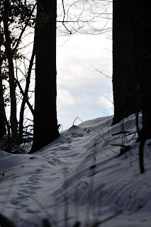
Another pleasure was to walk awhile along a stretch that had not been trodden by the deer. Fresh footprints on new fallen snow~~~
Even in winter there are moments of green. These laurel leaves above rock lichen were refreshing to encounter.

The texture of the bark on this black gum tree is a favorite. I have called it black gum, but never confirmed it with the guides. Anyone know their trees for sure?
Look here.
This was the first log bench I made. It is made from a piece of black gum log that we cleared.
Surrounding the sitting place is a ring of rocks that form a nice semi-circle to contemplate.
There are not a lot of large boulders along the first few miles of the Watauga Section. There is another outcropping of rock a little ways down from the gum tree that would be nice to sit upon. Someday perhaps the debris can be cleared and they can be explored.
The trail opens onto an old road bed at about the midpoint. I enjoy the contours as defined by the shadows in this shot.
And I always enjoy an "S" curve in the trail.
The deer have found our trail again and now we follow their prints.
I think of this as the "wiggles" forest because there are so many wiggly laurel trees.
These next three photos are a testimony to the survival and determination of the Laurel. This huge one fell in the ice storm last year and we had to cut it out of the trail.
In just one year it has sprouted. You can knock them down but they get right back up!
Nice pattern in the middle of the cut too.
Such determination to survive.
One of my favorite switchbacks. Blocked on the inside and outside of the turn by oak fells and debris. There will be no switchback shortcutting here!
The top side curves out with a sweet grace. I remember the day we cut this trail.
(revisit here)
Near the end of this section the trail levels out at the top of the ridge.
Heading south the hiker will encounter this trail sign indicating a need to turn to your left ahead.
(on the south side, the northward hiker will see this signage)
The trail opens onto an old road bed at this point.
Which levels out into a thoroughfare!
The next point of note is a driveway at the end of this road. Note the blazes.
At the double blazes indicating a trail direction change the following information is provided: Turn Left (at driveway) Cross the Road (Wildcat Road) Turn Left on Second Road (Carrol Eldreth Road) and then Right onto the MST in forest.
Take a moment as you step out of the forest to cross the driveway to notice the distant view.
Snake Mountain on the left gets its name from the serpentine ridge line and Elk Knob on the right is our newest state park. There is a wonderful trail being constructed to the top of Elk Knob that I highly recommend.
As you step out from the driveway you will be crossing Wildcat Road. Look to the right as you leave the driveway and you will see Bill Stewarts wood pile. It has been greatly reduced this winter!
(look here)
But, there is plenty left. If you are in need of good wood Bill is the man to see.
On the opposite side of the wood mans yard you will see a private road, Carrol Eldreth road. About 100 yards down this road on the right you will see our trail head.
There is an old oak whiskey barrel that sits just at the trail head.
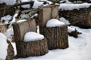
This section winds in an S curve a few hundred yards to the bottom. These two cut offs from a poplar fall make a sweet seat for two children.
This is the exit point from the forest onto the parkway. This one is a treat because you can not see what a big view you will encounter on the other side until stepping out.
But, first there are some deep wind shaped drifts to be waded through.
One of these was almost three feet deep!
As you can see, our trail post is completely buried!
For each of these sections I am posting a map created by Arthur Kelley.
I will include a close-up section of the map for each of these parts to the Watauga Section. These maps have been constructed by Master mapmaker Arthur Kelley. Arthur has hike all these sections, logged his GPS coordinates and overlaid them on the contour maps. They are also linked to Google Earth and you can explore from the overflight of this magnificent high country therein. This is a wonderful, helpful, and impressive volunteer effort from this friend of the MST. Thank you Arthur Kelly.
A link to his maps is provided here for your perusal.


